
What is tonghou?
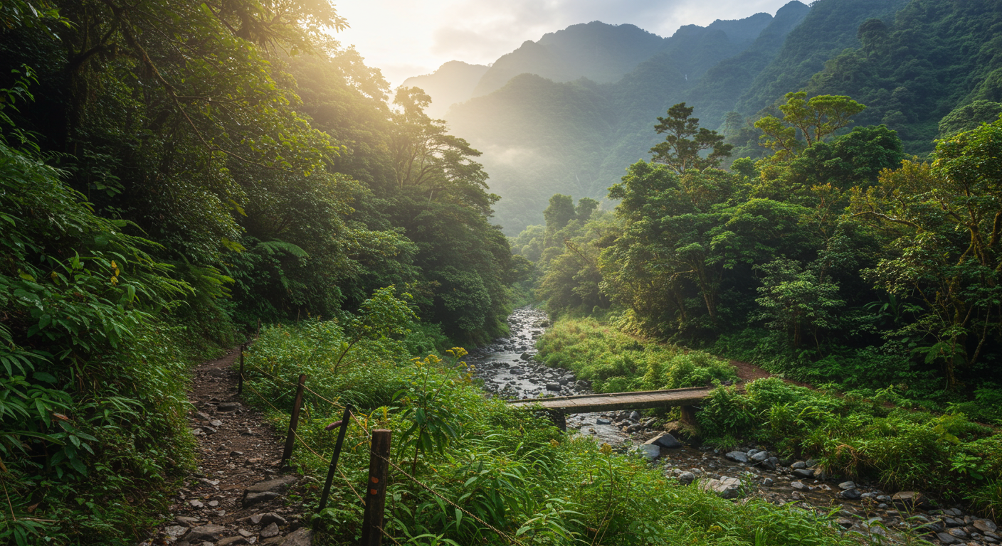
Tonghou is a breathtaking mountain trail in northern Taiwan, known for its lush jungles, crystal-clear rivers, and deep historical roots. It connects the Wulai District in New Taipei with Datong Township in Yilan.
This path was once a vital route for the Atayal indigenous people and later a forest road during the Japanese occupation. Today, it’s one of the most beautiful and lesser-known hikes in Taiwan.
Why tonghou Should Be on Your Hiking List
Tonghou is more than a trail—it’s a journey through nature, history, and cultural heritage. Here’s why it stands out:
Remote and quiet, ideal for a peaceful getaway
Surrounded by waterfalls, ferns, and towering trees
Offers both a physical challenge and scenic relaxation
Can be completed in one day or extended into a multi-peak trek
Trail Overview
Distance: Around 23 kilometers
Time Required: 6 to 9 hours
Difficulty Level: Moderate
Starting Point: Wulai (New Taipei)
Ending Point: Datong (Yilan)
Most hikers go from west to east, starting in Wulai and finishing in Yilan, but it’s possible to reverse the route.
History of the tonghou Trail
The tonghou trail dates back hundreds of years. It was originally used by the Atayal people, an indigenous tribe in Taiwan, as a travel and trade route.
Later, during the Japanese era, it became a logging road. Remnants of that time—old rail tracks, timber camps, and abandoned forest roads—can still be seen today.
What to Expect on the Trail
Diverse Terrain
You’ll walk through forest roads, climb steep slopes with ropes, and cross riverbeds. The middle part is more rugged, requiring good footwear and balance.
Jungle Canopy and Ferns
A large portion of the trail is shaded by dense canopy, which keeps it cool even during summer. Giant ferns, orchids, and moss-covered rocks create a fairy-tale atmosphere.
River Views and Crossings
The tonghou River runs parallel to parts of the trail. There are spots to dip your feet, refill water (with a filter), or rest beside small waterfalls.
Key Highlights
Mt. Datong and Mt. Xiaojiaoxi
If you’re up for a challenge, you can take side trails to nearby peaks like Mt. Datong. These offer 360° views over Yilan and the surrounding mountains.
Scenic Rest Points
The trail offers natural resting spots: large rocks near the river, grassy clearings, and cliff edges with panoramic views. These are perfect for photos or a quiet lunch.
When is the Best Time to Hike tonghou?
Spring (March to May)
Ideal temperatures and blooming flowers. The trail is firm and rivers aren’t too high.
Fall (October to November)
Cool weather and beautiful light. Fewer bugs and less rain than summer.
Avoid Summer Typhoons
Heavy rain can make the trail slippery and dangerous, especially during typhoon season (June to September).
How to Get There
From Taipei to Wulai (Starting Point)
Take the MRT to Xindian Station
Transfer to Bus 849 to Wulai
From Wulai Old Street, take a taxi or local minibus to the Tonghou trailhead
From Yilan (End Point) Back to Taipei
Finish in Datong Township
Take a local bus to Luodong or Yilan Train Station
Return to Taipei via express train
What to Pack for the tonghou Trail
Sturdy hiking shoes (some rope sections are steep)
Water (2–3 liters) and snacks
Sunscreen and insect repellent
Rain jacket or poncho
Portable water filter (optional, but useful)
Trekking poles (optional for balance)
Safety Tips
Check the weather before you go. Avoid hiking after heavy rains.
Always inform someone of your hiking plan and expected return.
Bring a map or GPS (signal is weak in some parts).
Watch for leeches in warmer months—wear long pants and use salt or repellent.
Can You Camp on the Trail?
Yes, but with limits. You can set up camp in clearings near the river or designated spots. There are no official facilities, so bring your own gear and pack out all waste.
Some hikers camp overnight and explore nearby peaks the next morning.
Local Culture Along the tonghou Route
You’ll pass through traditional Atayal lands. Look out for tribal carvings, shrines, and signs written in Atayal language.
Please respect local customs, don’t litter, and avoid making noise in sacred places.
Is It Suitable for Beginners?
The tonghou trail is moderate. Beginners in decent shape can complete it in 8 to 9 hours. However, due to the remote location and rope-assisted sections, it’s best done with:
A guide
A hiking group
Or someone experienced
Planning Your Route
There are three main options:
Point-to-point (Wulai to Yilan) – the full experience
Out-and-back from Wulai – great for a half-day adventure
Loop combining nearby peaks – for experienced hikers
Choose based on your time, fitness, and transport access.
Final Thoughts on the tonghou Experience
Tonghou is one of Taiwan’s best-kept hiking secrets. It blends raw nature, rich history, and tranquil views in one unforgettable trail.
Whether you’re a seasoned trekker or a weekend hiker, this trail will challenge, inspire, and reward you.
So lace up your boots, pack smart, and hit the tonghou trail—it’s calling your name.